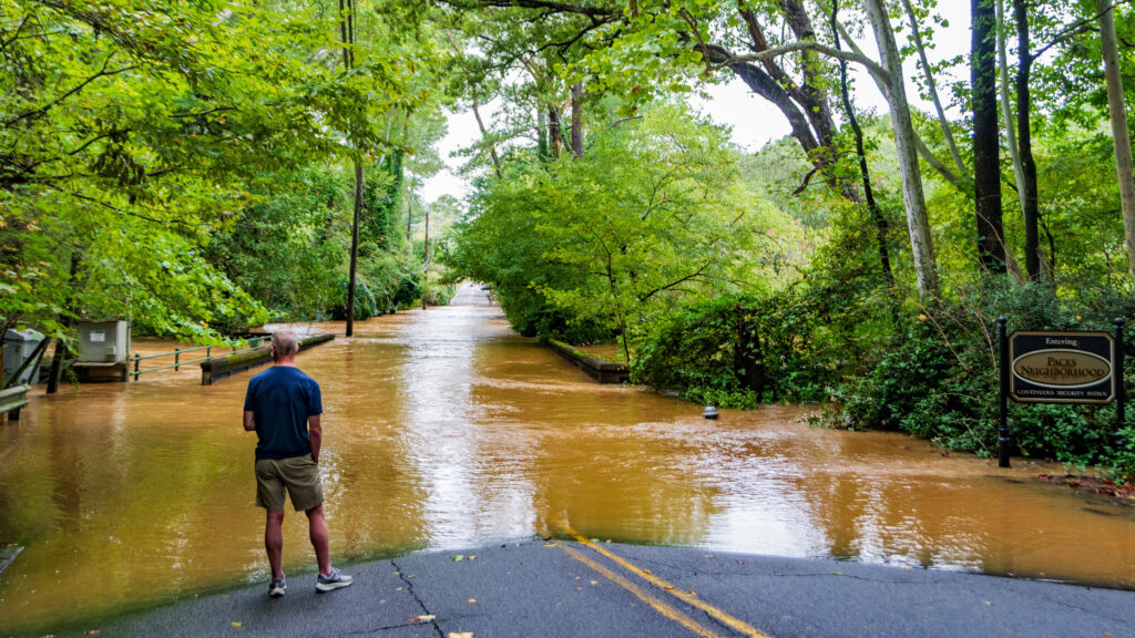
Hurricane Helene made landfall near Perry, Florida, on Thursday, Sept. 26. With winds reaching as high as 140 mph, the Category 4 storm was among the strongest to hit the United States recently. The hurricane left towns across the South destroyed, cities flooded, and homes upended.
Since last Thursday, the death toll has risen to at least 160 people; many of these deaths include people far inland due to the severe rainfall of the storm. Noted by a slight off-course shift after the hurricane hit land, the storm impacted areas farther east from Atlanta rather than going through it. This instead caused severe flooding in cities like Asheville, N.C., Greenville, S.C. and Athens, Ga.
Due to this change in trajectory, the impact on campus was less severe than anticipated. The hurricane resulted in nearly two days of rainfall (2-4 inches) and Tech shifting to two digital learning days. Dining halls and on-campus restaurants operated on modified hours, and buses were non-operational.
According to Dr. Ali Sahardi, assistant professor of climate, oceanography and weather meteorology at Tech, “the formation process [for hurricanes] begins when warm, moist air rises from the ocean surface, creating a low-pressure area below.” He adds that “as more warm air continues to rise and cool, clouds and thunderstorms form through convection.”
But to become a hurricane, the conditions must be favorable, “such as sufficient ocean heat, low wind shear, and high humidity — this cluster of storms can start to rotate due to the Earth’s Coriolis effect. As the system intensifies, it becomes a tropical storm, and if wind speeds exceed 74 mph, it is classified as a hurricane,” Sahardi said.
Sahardi said previous hurricanes like Ida rapidly developed from low-intensity storms to higher categories. “[This] scenario occurred with Hurricane Helene, which was a tropical storm that made landfall as a Category 4 hurricane within less than 48 hours.”
Dr. Zachary Handlos, another meteorology expert and EAS professor at Tech, states, “the primary concerns about trajectory are which cities are on the right side of the hurricane relative to its motion.” He adds, “As a result, cities in southeast and east Georgia experienced significantly worse wind damage impacts than we did in Atlanta, west of the center of Helene (where the wind direction was opposite of the storm motion, thus reducing the wind speed).”
Although Atlanta isn’t a coastal city, hurricanes can still significantly affect the area. Dr. Sahardi states, “strong winds and heavy rainfall from a storm like Helene could cause damage and flooding, major concerns for densely populated cities with extensive infrastructure like Atlanta.”
Since flooding wets the soil, the strong winds can cause trees to fall. Dr. Sahardi emphasized, “It is also crucial to have a shelter plan in place if severe weather strikes.”
Students on campus faced a variety of challenges. Arya Gujarathi, a first-year CE major at Tech, shared his perspective.
“My family’s from Fort Lauderdale, which is in South Florida, so they did not get very strong wind since the storm directly hit North Florida, but they did get like nonstop rain the whole day.”
In terms of preparedness, Gujarathi mentions, “I grew up entirely in Florida, so we hear about multiple hurricanes every year… it’s just normal for me… make sure you just constantly monitor the track… and make sure you have enough food and water.”
Another student, Chandler Parker, an Atlanta local and first-year BA at Tech, shared her thoughts about the situation.
“The hurricane impacted me personally as I had many quizzes and projects that were all of a sudden postponed, interrupting my schedule, and causing many important events I needed to go to be canceled for the foreseeable future.”
She mentioned she was shocked by Helene’s initial path for Atlanta and how bad the rain got, as she didn’t think it would be that big of a deal at first. Parker mentions that since her family lives nearby, she decided to go home during the storm.
Kusal Patel, a first-year CS student at Tech, shared his experience this past weekend.
“As a freshman, this experience was invaluable in preparing me for disasters that may happen in the future. Although classes shifted to a virtual format, the transition was smooth, making it feel as though we were still sitting together in the classroom,” Patel stated. “My everyday life was not affected as much as it was for my family back in [my] hometown. Metter, Ga. took a big hit, where power and services have not been restored yet.”
With climate change continuing to impact weather patterns, experts like Sahardi andHandlos emphasize the importance of advanced forecasting and model tracking.
“The models simulate the track and intensity of the hurricane, with some models run as ‘ensembles,’ where they simulate the hurricane several dozen to hundreds of times by slightly changing the initial data entered in the model at the starting time to see the variability in track paths and intensity.” Dr. Handlos stated.
This information allows cities to predict storm paths and intensities better, better prepare for natural disasters in the future, and ensure overall safety.
“With global climate change, SSTs [sea surface temperatures] will continue to increase on average every year. This, along with increased air temperature and moisture content of the air over the next few decades, will aid in creating an environment where the strongest tropical cyclones (i.e., category 4 or 5 hurricanes) are expected to increase in frequency.” Sahardi said.
The post Hurricane Helene Strikes the USA: Georgia Tech Responds appeared first on Technique.
